-
Dorene Lorenz published Alaska Steam Laundry Company in Historic Properties 2023-10-22 20:52:33 -0800
Alaska Steam Laundry Company
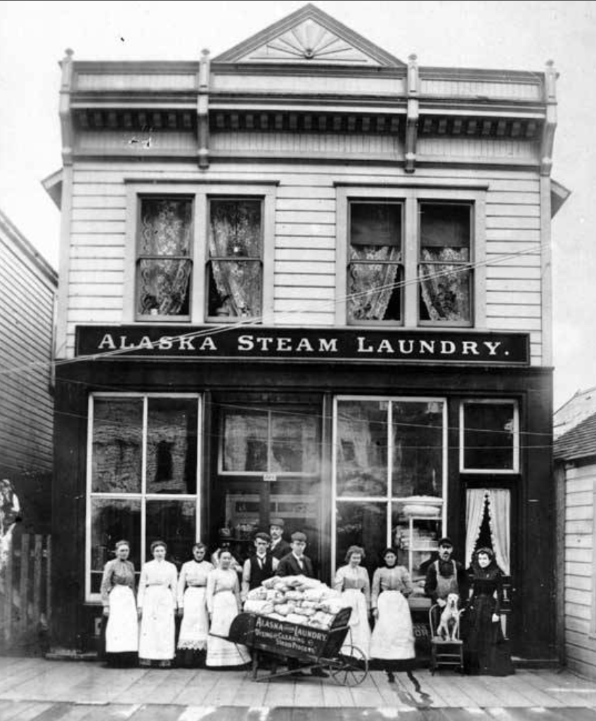
The Alaska Steam Laundry Company building at 174 South Franklin Street is an excellent architectural example of an important commercial enterprise which bridged the historical continuity of 19th and 20th Century Juneau.
When it became apparent after the 1880 placer gold strike that Juneau would not be a quick "boom and bust" camp —but rather would enjoy a long, prosperous future, with great mechanized mills, mines and a large payroll of miners, it grew more progressively than other mining camps and reached a level of sophistication surpassing any other in Alaska in the 19th Century.
This was assured by, first, the Treadwell mines, just across the narrow Gastineau Channel on Douglas Island. Deep mining started there in 1882, and by 1885, four corporate groups were mining with several stamp mills and a smelter were in operation.
In 1890 all operations at Douglas consolidated into the great Alaska Treadwell Gold Mining Company. It had then produced $14,000,000 from its four mines and 880 stamps in five mills. It would add some $40 million more to this by 1917 when wiped-out by an unexpected ocean cave-in.
On the Juneau side, starting the same pattern only a few years later, the Alaska-Juneau Gold Company, began acquiring all claims in that district, combined into one great mine and mill which operated up to 1948 and produced $67 million in gold.
Juneau was officially made the capitol of Alaska in 1900, with the executive offices gradually moved from Sitka by 1906. This brought about the residence here of most of the territorial and federal employees in Alaska, in seven territorial departments and 27 federal offices.
At Tacoma, Washington in 1894, Ernest Reinholt Jaeger and his wife, Anna Jaeger, flipped a coin to determine whether they should move to Hawaii or Alaska. The coin favored Alaska.
In January, 1895, Mr. Jaeger selected Juneau as the most promising business location in the Territory, and arrived by steamship from Seattle. Because of the extensive payroll of miners and millworkers—mostly single—laundry and cleaning was a lucrative enterprise.
He leased the Juneau Steam Laundry from A.H. Day, then located in log cabin on the hillside at the end of 2nd just beyond where the Baranof Hotel was later built.
Anna joined him in March, traveling on the maiden voyage of the new flagship of the leading Alaska line, Willapa. The Jaeger family, soon increased by the birth of a daughter. Hazel Jaeger, lived in an adjoining cabin and operated the laundry from there for several years. Then they moved to a larger existing building on Front Street.
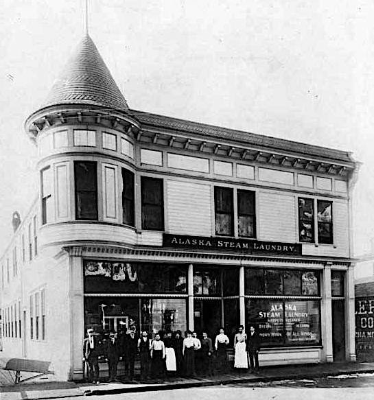
Having prospered, he decided to build a show-case operation which would have outlets in Apollo, Valdez, Sitka, Ketchikan and Wrangell; thus the name: Alaska Steam Laundry.
The Jaeger's resided in the master apartment upstairs while Hazel attended local schools. Then they built a home on Fourth Avenue.
While attending Juneau High School, Hazel was a classmate of James Simpson MacKinnon AKA Sim MacKinnon, son of a pioneer Fortymile and Juneau mining family.
Hazel attended Mills College in California and then returned to Thane, Alaska to teach.
Sim MacKinnon was appointed to the U.S. Naval Academy and graduated as an officer.
They were married in 1923 and spent several years in the Orient, where their son, J.S. Jr., was born, at Manila.
In 1926 Slim retired from the Navy and returned to Juneau to take over management of his Father-in-law’s laundry business.
No longer "Alaska Steam", nor at the same location, the business continued into the fourth generation with grandson Neil MacKinnon, who graduated from the University of Alaska at Fairbanks.
Alaska Steam Laundry is one of the better existing examples of the transition of Juneau from mining camp to Capital City.
-
Governor's Mansion
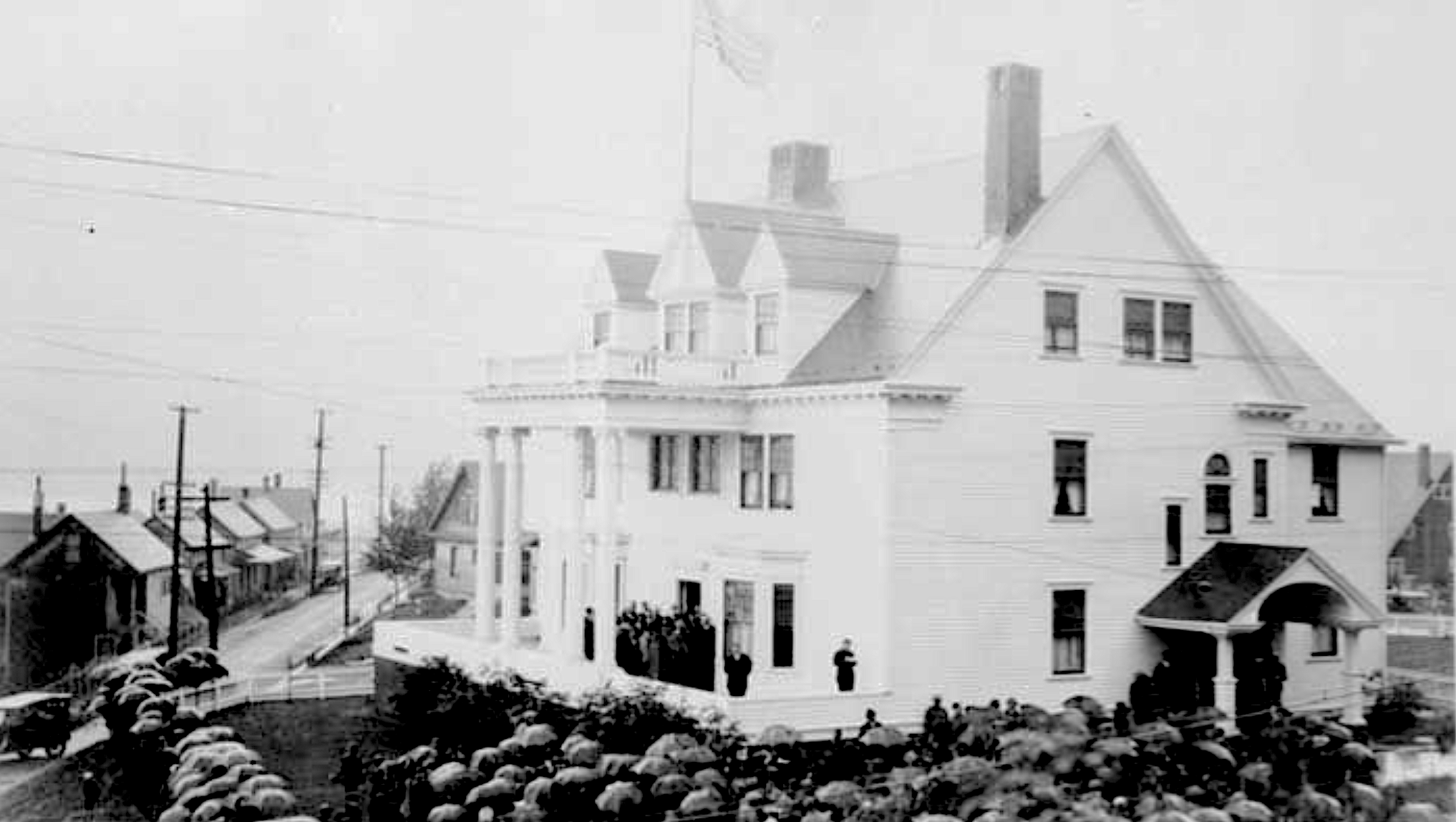
The Governor's Mansion was designed by James Knox Taylor. He was a Fellow of the American Institute of Architects, then serving as the first Supervisory Architect for the U.S. Treasury Department.
Taylor utilized design premises which had succeeded in Eighteenth Century English and American Colonial country houses.
These houses were designed to produce the most usable space for the cost, with facilities to perform the formal institutional functions required, and spaces amenable to formal and informal living under the same roof.
The examples he appeared to have followed had succeeded in performing these functions. The modifications he designed into this building succeeded admirably. An additional virtue of his design is that it permitted the basic building to be constructed and pressed into full service, with additional finishing construction, furnishing and decorating accomplished over a long period of time, as funds and authorization were provided.
An Act of June 6, 1900, provided that the temporary seat of government for the District of Alaska would be established in Juneau "when suitable grounds and buildings are available." From the passing of this 1900 Act by Congress until the Mansion was completed and occupied in 1913, a series of events—dramatic when considered as a totality moved forward the concept of more self-government for the Territory.
Continued Congressional attention to Alaska resulted in an Act for the Protection of Game, June 7, 1902; an Act Creating Road Districts and Providing for Road Overseers, April 27, 1904; the long-sought Delegate in Congress Act, May 8, 1906. The site of the building had been reserved in 1911 by Executive Order of the President, Number 1331. The Second Organic Act, August 24, 1912 provided that the capital of the Territory ". . .shall be at Juneau."
The Governor's Mansion, already under construction when the Act became law, thus became the first public building constructed for the new permanent capital of the Territory. The Alaska Governor's Mansion was first occupied by the Territorial Governor, Walter E. Clark, and his family, on January 1, 1913.
The Act also created a legislature of twenty-four members—two Senators and four Representatives from each of the four judicial division—to convene "at the capitol at the city of Juneau, Alaska on the first Monday in March in the year nineteen hundred thirteen, and on the first Monday in March every two years there after." The first legislature convened in space rented in the local Elks Club hall.
Juneau was a busy community. It had been founded as a mining camp, and had flourished as a result of the mines on both sides of Gastineau Channel and the marine commerce spawned by traffic between the lower states and the greater Alaska to the north and west.
A. H. Humpheries, an official of one of the mines recalls what Juneau was like in the era when the Governor's Mansion was under construction and the Territorial Government was about to begin full operation in the town, "Juneau in 1912 was alive and booming.
I had gone there from "The Westward" as we called it, out around Cordova and Valdez, after two memorable years in the Kennecott copper and Valdez trail country. ...men were shaved and groomed. Businessmen were in city clothes. A great treat to us was to see women and children on the streets and in the stores. ...the streets were thronged with pedestrians on the sidewalks. Horsedrawn vehicles threaded the centers.
I had spent five years in New York City. It never appeared to me so civilized as Juneau did that first day in 1910. The stores were busy, and displayed good merchandise.
Both the raised sidewalks and the streets in the main part of the city were of planking. They were very clean with streams from fire-hose nozzles. There was an efficient sewer system, ample electricity, and a telephone exchange with "hello girls" who would trace a party for you anywhere they could be reached. ...
The morning following our arrival, after breakfasting..., we sought out the source of the town's activity—the office of the Alaska Gastineau Mining Co., in the Valentine Building . . . and walked out with jobs. My friend was to work with Herman Tripp at Sum Dum Mine. ...Ed Russell published the "Dispatch." . . . "The Juneau Empire"... later, founded by John F. Strong and John W. Troy, . . .They had been associated in Nome with the "Nugget," and much later became governors of the Territory. ...
There was a staff-house with "private mess" down by Gold Creek at the foot of the tram and a big bunkhouse and a mess hall up the hill near the mine.... The mine was in the development and construction stages. Everybody in the organization was new and came from some other place.... ...the Alaska Gastineau mine was being developed for 6.000 tons of ore daily output.
The Alaska Juneau Mine, with an even more modern reduction plant, was planned for 10,000 tons a day, while across the channel the thirty-year-old Treadwell Mine properties were producing enough ore to keep some 2.000 stamps continuously pounding it to pulp 363 days a year. All this activity made the Juneau-Douglas operations for a short time at least, rank as the hard-rock miners' capital of the world....
I was thirty in 1913.... The very recollection of . . . that period fills me with pleasure. We can never recover the feeling we had toward each other in that distant simple age. The nearest I can think of to parallel it, would be a cruise ship that had been long enough at sea for everybody to get acquainted. We had a feeling of being of the world, but separated by time and distance. We were constantly refreshed by the arrival of new people from "below." ... at that period I had never met an adult Caucasian born in Alaska....
In 1912, the only automobile in town was Bart Thane's official Model T. It was chauffeur operated. The streets seemed full of horse-drawn vehicles, buggies, delivery wagons, big Studebaker ranch wagons, a lot of them designed so runners could be substituted for wheels when snow descended on the town. The freighters used "common sense" bob sleds in winter. There was no snow removal at that time. We just tromped it down and wore it out.
There was no radio, and no television in that distant age. But there was plenty of diversion in the big social hall for those off shift. We formed the Ptarmigan Club, and invited the whole town to a house warming dance when the place was opened for business....
It was almost the last stand in Alaska and in the West of the now forgotten art of driving workhorses. . . a string of five or six four-horse or six-horse teams, hitched to heavy Studebaker wagons, loaded high and safety-lashed, teamsters sitting on top or even standing precariously for a better view fore and aft with a handful of lines, would pull out of Willoughby Avenue at a fast walk along Front Street and then, with infinite care make the sharp turn up Seward—hoofs pounding, chains rattling, harness creaking, wheels rumbling, every axle speaking its piece—the leaders prancing proudly with necks arched under their reached manes. One team after another, that was the scene twice a day for several years. . . .
Jay Hayes, Alaska Road Commission superintendent . . . had to keep roads up without money.... By 1915 a few more autos appeared on the streets, plus a few delivery trucks. . . . Cash Cole bought a little red Model T. Doc Loussac, the druggist, had a black one shipped up....
Juneau was a busy seaport with big cargo and passenger ships docking nearly everyday and sometime three or four...."
-
Dorene Lorenz published 2023 Wood Stacking Contest in Wood Stacking Contest 2023-10-18 17:28:45 -0800
Wood Stacking Contest
Printed in the Juneau Empire, 20 October 20223.
Stockpiling firewood for the winter has moved up a notch, as participants in the first annual Pioneers of Alaska wood stacking contest will tell you.
Read more
Competitors in the Juneau area showed off their stacking abilities in six different categories, piling up bragging rights for excelling in their demonstration of old fashioned self sufficiency skills.
-
Historical Events
1918 Princess Sophia Sinking
Posted by Fred Thorsteinson · October 24, 2024 6:13 PMDouglas City Founded
Posted by Dorene Lorenz · January 10, 2024 1:56 PMGold Discovered, Juneau Founded
See all posts
Posted by Dorene Lorenz · January 07, 2024 8:11 PM
-
Treadwell Mine
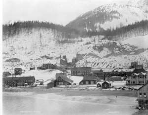
When Richard Harris and Joe Juneau returned to Sitka with news of their find, a French Canadian French Pete Errusard learned of a gold bearing outcrop on Douglas Island across Gastineau Channel. He staked adjacent claims in 1881, along with others.
Rumors of the gold discoveries in the Gastineau Channel area reached San Francisco, and a group of mining investors sent John Treadwell to investigate in August of 1881.
Treadwell staked claims in Silver Bow Basin and purchased Erussard’s claims before returning to San Francisco with some ore samples that showed promise of good returns when tested.
The mining town of Treadwell was established, along with Douglas City.
The Alaska Mill and Mining Company was soon organized with Treadwell appointed as superintendent of mining operations.
He returned to Douglas in May of 1882 with a 5-stamp gold concentrating mill to test the ore on the Paris Lode claim and purchased additional adjoining claims.
By 1884 a 120-stamp mill was completed, and the Treadwell mines were on their way to fame. The success of the first development drew hundreds of prospectors to the area. In 1889 the recently incorporated Alaska Treadwell Gold Mining Company bought out all investors, including John Treadwell, for $4,000,000.
In the early 1890’s two mining companies initially financed by the Treadwell Company were incorporated, the Alaska Mexican Gold Mining Company and the Alaska United Gold Mining Company.
Each of the three companies was financially separate, but the Treadwell Company managed all of them.
The Treadwell mines pioneered in the field of low cost mining and the use of hydroelectric power. The power was used to convert all of the steam-run hoists and mills into economical electrically driven machines.
Under the guidance of Frederick W. Bradley, world famous mining engineer, the Treadwell complex reached peak capacity in 1915.
Over 2,000 men worked above and below the ground and supplied the mills with 5,000 tons of ore daily, which was a world record at that time. The mills and mines ran 24 hours a day seven days a week, except for the Fourth of July and Christmas.
The Treadwell complex which included four major mines consisting of the Treadwell, 700-Foot, Mexican, and Ready Bullion, was a first class, innovative mining and milling operation that spanned 36 years until 1917 when a disastrous cave-in flooded all but the Ready Bullion mine which ran until 1922. Fortunately no human lives were lost, but one man was reported missing.
The Treadwell neighborhood is immediately south of the original Douglas Townsite and includes the area historically known as the Treadwell Mine and Town sites.
The neighborhood is composed of residential buildings as well as a ruins of mining structures and buildings. Most buildings are wood frame construction reflecting the available materials and historic building technology.
The few reinforced concrete structures included in the survey are located within the Treadwell Mining Complex and were influenced by the higher technology brought to Juneau by the mining engineers. Although many buildings in the neighborhood reference the period architectural style they are predominately modest in detailing.
Treadwell Mining Complex: Historic Resources and Site Survey Report.
Inventory and Survey of Historic Cemeteries in Douglas, Alaska
-
Dorene Lorenz published Tidelands Historic Neighborhood in Historic Districts and Places 2023-10-15 20:41:24 -0800
Tidelands Historic Neighborhood
Once primarily beach lands, the tidelands neighborhood was filled with waste rock of the Alaska Juneau Gold Mine.
The area is bounded by the Gastineau Channel on the east, Willoughby Avenue on the north and west, and Gold Creek on the south.
The only historic building identified in the neighborhood is the Pacific Coastal Steamship Company AKA Alaska Coastal Airlines Hangar, which is commonly referred to as Merchant’s Wharf. No other historic buildings remain in the neighborhood.
-
Dorene Lorenz published Telephone Hill Historic Neighborhood in Historic Districts and Places 2023-10-15 20:38:47 -0800
Telephone Hill Historic Neighborhood
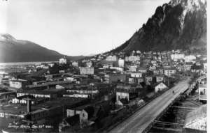
Telephone Hill is one of the oldest, continuously occupied areas in Juneau, and was part of the original Juneau Townsite Survey. The Pioneers of Alaska Juneau Igloo voted unanimously to formally request that the City and Borough of Juneau preserve this historic neighborhood.
In 1881, the U.S. Navy established a government reservation on the northern portion of the hill and constructed a military post. The hill's geographic prominence provided the Navy with a strategic vantage point from which they could maintain law and order in the raw mining town.
After the Navy abandoned the post, two government court houses were erected on the reservation beginning in 1893, and completed by the ·General Land Office in 1894. The first court house, erected in 1893, burned in 1898. The second court house was constructed in 1904, and remained on that site until razed for the construction of the present State Office Building.
Turn-of-the-century photographs of the townsite show residences on the hill, a few of which still exist today. With its sweeping view of Gastineau Channel and Douglas Island, the hill has been an attraction throughout the area’s history of habitation.
The neighborhood lies south of Third Street and is bordered by Main Street and Willoughby Avenue. The upper portion, north of Third Street, was once the location of the Government Court House until the late 1960’s. Today the State Office Building occupies the site.
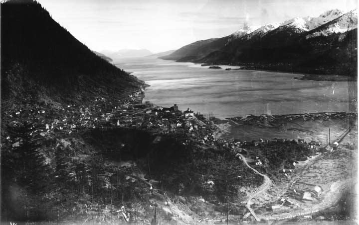 The name Telephone Hill became firmly attached to the area when Edward Webster, owner of the Juneau and Douglas Telephone Company, located his business on the summit of the hill. The business remained in the Webster house until the 1957, when POA Charter Member Anna Webster, who was running the company after his husband's death, passed away.
Several long-time Juneau businesses were situated in the study area. Attorneys Edward Bayless and Lewis Shackleford had a law library in the Edward Bayless house on Telephone Hill. The 1914 Sanborn map notes that the offices of the Pacific Coast Steamship Company and Wells Fargo Express were located in a building south of First and Main Streets.
The Winter and Pond Photography Studio, the U.S. Cable Office, and the Juneau & Douglas Telephone Company were located in the Horseshoe Building at the corner of First and Main. Empire Printing was located between First and Second on Main Street. The Alaska Road Commission had a barn and stables at the base of the hill.
The Telephone Hill Historic District is threatened with destruction as most of the development plans proposed to the City and Borough of Juneau in 2023 called for bulldozing all the historic structures. See 3 January, 2024 Anchorage Press Article for details.
Structures in the Telephone Hill Historic District:
Districts are generally groupings of buildings or structures whose significance can be other than historical visual, architectural and environmental. Groups of buildings can create a specific environment physically and spatially by representing the standards and tastes of a community or neighborhood during a period of history. Unrelated structures often collectively display a progression of styles and functions or cohesive townscapes.
The structures at the Telephone Hill summit, constructed between 1882 and 1939, are collectively significant and create a district. Two factors contribute to the district's significance: The site's association with the early development of Juneau; and the buildings' architectural details reflecting the changing construction designs during the past century. Using National Register criteria, the Telephone Hill structures were determined in the Telephone Hill Historic Site and Structures Survey, 1984, to meet the qualifications of the National Register of Historic Places for a Historic District.
CBJ Telephone Hill Redevelopment Documents
Juneau Telephone Hill Market Analysis, Feasibility Analysis and Development Strategy
-
Dorene Lorenz published Starr Hill Historic Neighborhood in Historic Districts and Places 2023-10-15 20:30:11 -0800
Starr Hill Historic Neighborhood
As the Juneau Townsite began filling up with new development adjacent hillside lands began showing promise for expansion. One such area was just north of the original Juneau Townsite.
Named for Frank Starr, the neighborhood was home to the working class of miners primarily from the Alaska Juneau Gold Mine. Starr had made some mine claims but was primarily a builder and contractor. Starr Hill was a popular neighborhood for mine workers as it was close to the mines and downtown.
The boundaries of Starr Hill comprise an area north of Harris and Gold Street and between Second Street and Sixth Street. Within this neighborhood is a small group of homes which were all built at approximately the same time and of the same design.
They were built for mine employees and their families - not by the mining company but by local investors and builders.
Kennedy Street Historic District National Register of Historic Places listing
-
Dorene Lorenz published Juneau Townsite Historic Neighborhood in Historic Districts and Places 2023-10-15 20:27:35 -0800
Juneau Townsite Historic Neighborhood
The boundaries of the Juneau Townsite historic neighborhood are generally the north side of Second Street to the north side of Sixth Street and the east side of Calhoun & Main Street to the west side of Harris & Gold Street. The neighborhood is a part of the original Juneau Townsite as platted in 1881 by Navy officer Master Gustave Carl Hanus.
The neighborhood is comprised of primarily residential buildings with some commercial buildings in the area from Second Street to Fifth Street.
Most buildings are wood frame construction reflecting the available materials and historic building technology. Some later structures are of reinforced concrete likely influenced by the higher technology brought to Juneau by mining engineers.
The architectural style of the historic buildings in the Juneau Townsite neighborhood can be traced to national style trends of the period. However, most are modest in detailing. This is most likely a result of the economy of shipping materials to this remote part of the world and the limited availability of skilled craftsmen in the region.
Buildings in the neighborhood are truly representative of the historic socioeconomic diversity of the Juneau population at that time ranging from the finely detailed Queen Anne homes of the wealthy to the simple houses of the working class. The neighborhood was under extreme developmental pressure during the turn of the century as the community grew rapidly during the period of gold mining expansion.
The Juneau Townsite neighborhood comprises a unique historic area featuring many fine examples of early period architecture reflective of the geographic and economic influences of the early development of Juneau.
Juneau Townsite National Historic Register Listing
Juneau Townsite Historic Building Survey, 1988
Juneau Townsite Historic Building Survey, 2023
Juneau Townsite Historic Building Inventory 1, 2023
Juneau Townsite Historic Building Inventory 2, 2023
-
Dorene Lorenz published Douglas Indian Village Historic Neighborhood in Historic Districts and Places 2023-10-15 20:20:05 -0800
Douglas Indian Village Historic Neighborhood
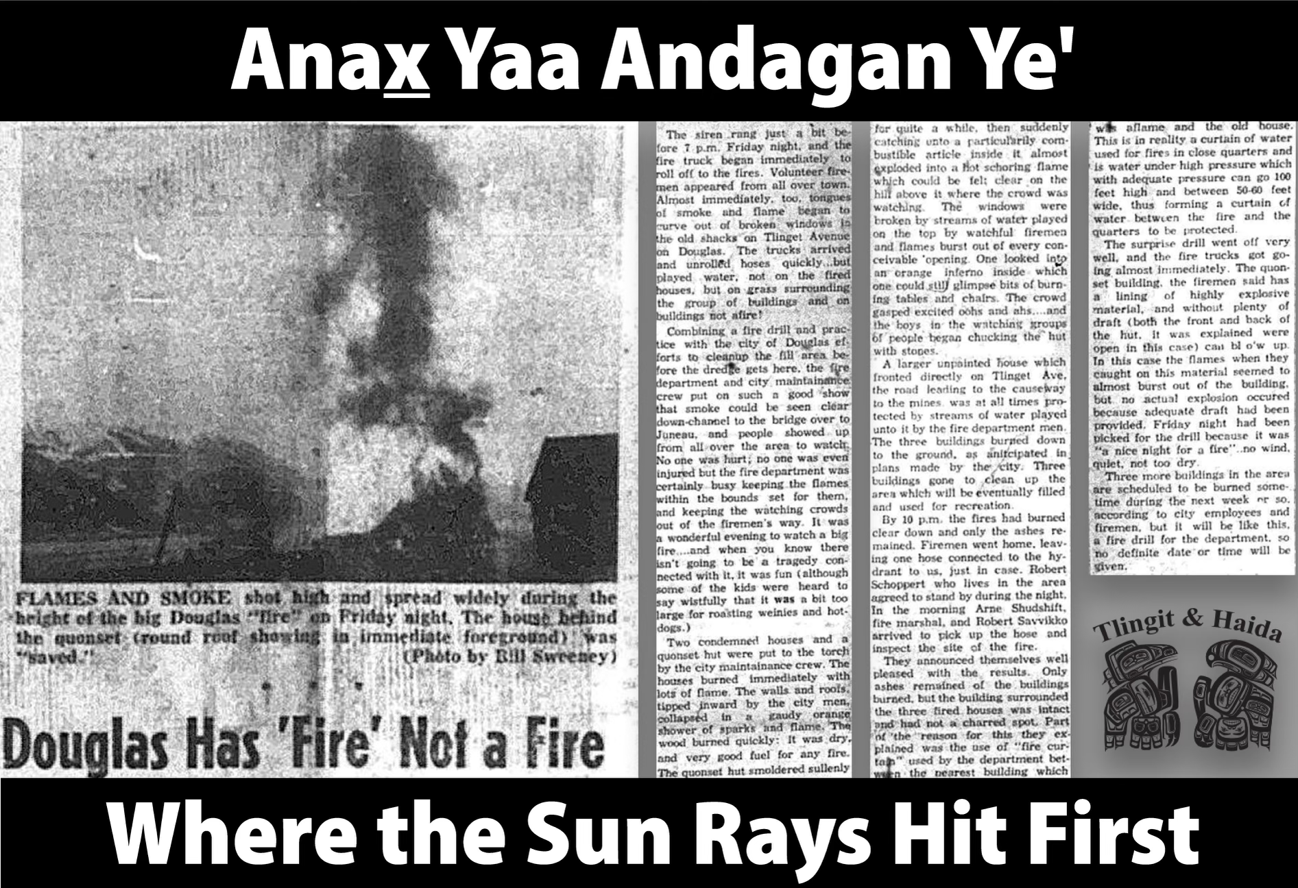
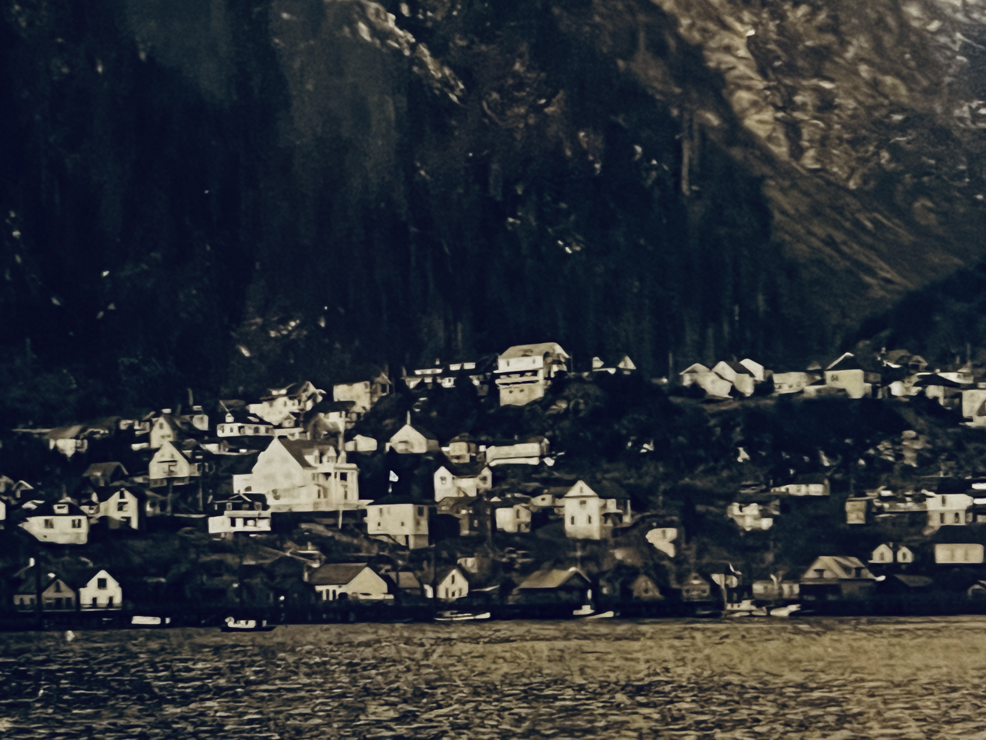 Tlingit families settled in the area from around Southeast Alaska, many from the Taku River area. They lived along the waterfront between the mine and the town of Douglas in the Douglas Indian Village on houses set on pilings.
They named the village Anx Yaa Andagan Ye', which translates to the place where the sun first hits.
The Natives were employed as laborers at the Treadwell mines and for construction of the Treadwell Ditch which brought water to the mills.
-
Dorene Lorenz published X'unaxi, Juneau Indian Village Historic Neighborhood in Historic Districts and Places 2023-10-15 20:18:39 -0800
Juneau Indian Village
What has come to be known as the “Indian Village” was traditionally called “Lingit Aani” by the local Tlingit people. The area was once the traditional summer village site of the Auk Tlingit Natives.
The neighborhood lies within the area bounded by West Willoughby Avenue on the south, Distin Avenue on the north, Indian Street on the east, and Capital Avenue on the north. The entire neighborhood is recognized as an historic site of the Auke Village.
Only a handful of historic buildings remain. These have not been surveyed and therefore are not named individually.
Auke Cape Traditional Cultural Property Investigation
Tlinglit settle Juneau Indian Village
-
Dorene Lorenz published Historic Shipwreck Sites in Historic Districts and Places 2023-10-15 20:12:33 -0800
Historic Shipwreck Sites
The lifeline of Southeast Alaska has always been maritime travel. The first mariners in Southeast Alaska were the Tlingit and Haida Indian tribes. They constructed large ocean going canoes to travel long distances for trade, to visit other villages or to wage war. Later, the region was explored by the French, Spanish, and British, but none had a larger presence than Russia.
Following the United States purchase of Alaska from Russia in 1867, steam powered ships carrying occupation troops and supplies for new settlements traveled throughout the region. Prior to this time, the Alaska coastline was shunned by all except for explorers and traders.
The Southeast Alaska waterways were known as some of the most challenging in the world, due to treacherous tides, winds of gale strength, poor visibility, and unmarked reefs. With these factors and the increased maritime traffic, it resulted in an increase in maritime disasters.
Over a dozen shipwrecks have been identified in Lynn Canal, which was a most direct route to Dyea, the gateway to the gold fields.
-
Dorene Lorenz published Douglas Historic Cemeteries in Historic Districts and Places 2023-10-15 20:06:15 -0800
Douglas Historic Cemeteries
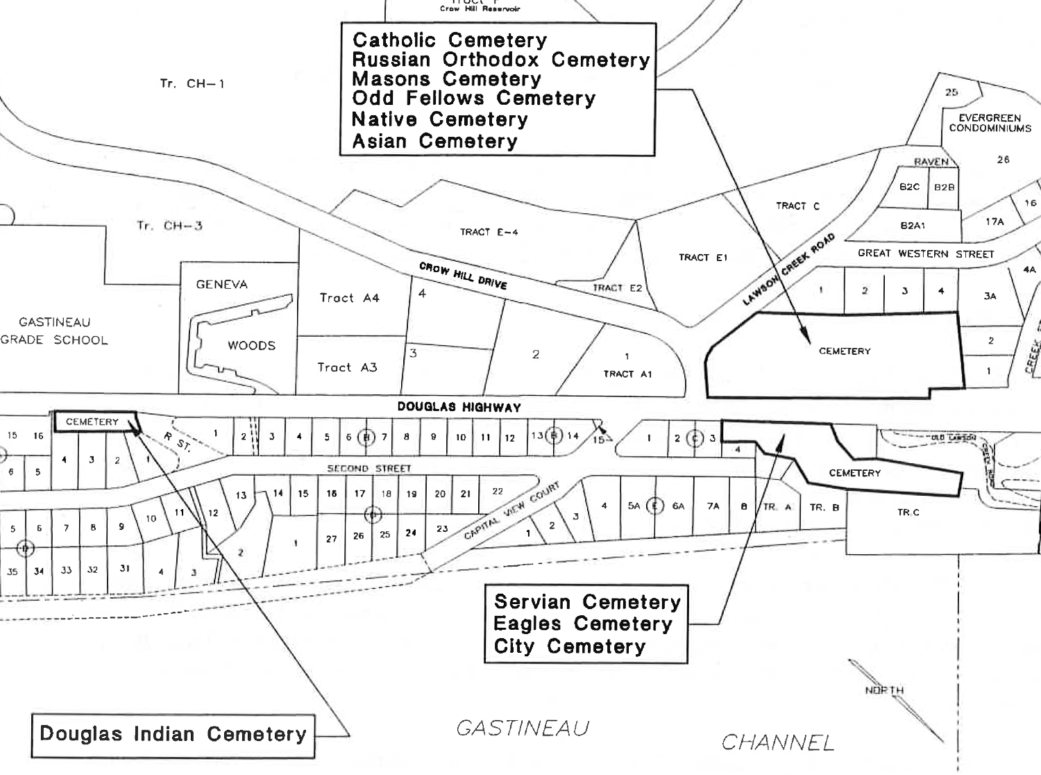
A 1995 historic sites and structures inventory identified three non-continuous cemetery sites on Douglas, known generally as the Douglas Catholic Cemetery, Eagles Cemetery, and the Douglas Indian Cemetery.
All three cemeteries are located along Douglas Highway within a mile and a half of each other. While documenting the cemeteries, it was uncovered that two of the cemeteries were actually made up of a grouping of smaller cemeteries.
The Catholic Cemetery includes the Catholic Cemetery, the Odd Fellows Cemetery, the Masons Cemetery, the Native Cemetery, the Asian Cemetery, and the Russian Orthodox Cemetery.
The Eagles Cemetery is made up of the Douglas City Cemetery, the Eagles Cemetery, and the Servian Cemetery.
There was no cemetery in Douglas in the early 1880's and 1890's. In 1887 there were no newspapers except in Juneau and little mention was made of deaths in Douglas or Treadwell, unless it was a major mine accident. The Douglas Island News was established in 1898 and vital statistics were recorded.
One article states that Douglas people were buried in Juneau before 1900. Some may have been buried in the "Ridge Cemetery" (Chicken Ridge) as early as 1887 and in the Evergreen Cemetery which was developed in 1888-89. A few deaths were recorded in 1899, and in August of 1900 people were reported as being "buried in the old cemetery." It is not clear whether or not they meant Douglas. There may have been some burials near the outskirts of town before the establishment of the "new" cemetery.
The first issue of the Douglas Island News in 1898 stated that a movement to start a cemetery occurred at a public meeting. In the August 1900 issue the editor commented, "In constructing a cemetery on Douglas Island a very peculiar condition presents itself Will Douglas citizens bury their dead on Douglas Island?" He goes on to say that there "are numerous graves tended and fenced by Douglas relatives (in Juneau) and would families want to be separated." The old cemetery was known all over Alaska as the Juneau-Douglas Cemetery. Yet the citizens of Douglas wanted their own burial ground.
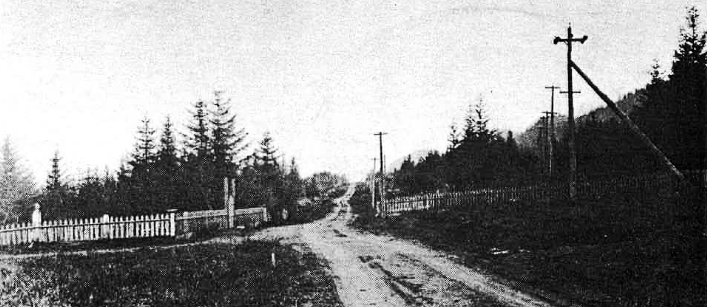 In 1899 mining engineer W.A Sanders, W.A Thompson, and Minnie Ross Holman applied for a patent to mining claims which took in the northwest end of the town of Douglas, including streets and buildings. The ground consisted of over 50 acres which included 13 lode claims and some mill sites. A committee was formed to protest this patent.
Sanders agreed that if the committee did not protest his application for patent he would deed back "all lots, easement of streets, etc. and other points in which his patent interfered with the town of Douglas." This was later agreed to in writing.
The committee asked for ground for a cemetery. Sanders agreed to give the people of Douglas "the dry knoll this side of Lawson Creek" if they would not object to his patent.
He also agreed to build a road to the grounds, but declined to put it in writing and said his word was good.
Immediately after the meeting, a Cemetery Committee consisting of P.H. Fox, M.J. O'Connor, Reverand Peplogle and W.C. Boyd took possession of the knoll and ran a line from Third Street in Douglas to the area.
Shortly after Sander's verbal agreement the Cemetery Committee hired three men and started clearing a trail, which later became a gravel road, from Third Street in Douglas to the knoll.
The land claimed was "to the left' of the gravel road on the bench from the gulch where the road strikes the bench, to Lawson Creek." The road was approximately one-half mile in a straight line. About 30 feet of planking was done from the end of Third Street to the "Old Indian Graveyard" (Douglas Indian Cemetery) and three small bridges were constructed. Two acres were cleared and between four and five acres were enclosed by a wire fence. This description fits the location of the current City Cemetery.
Though W.A Sanders was a noted mining engineer, it was felt among the citizens of Douglas the Sanders' claims were not valid because he was a resident of Nova Scotia, Canada. Apparently the patent office did not agree. In 1900, Sanders obtained a patent to part of the mining claims.
He kept his written word and deeded back the land and buildings, but refused to honor his verbal agreement regarding the cemetery, in fact he denied making it.
Eventually he admitted he had made the agreement but "he wasn't going to buy land and pay out money for it and then give it away." Mr. Sanders was informed that the people of Douglas had earned the cemetery ground because they did not interfere with his patent. They even offered to pay him the government price of $5.00 an acre. He did not feel that was enough. It is not stated what the final outcome was.
Sanders did post no trespassing notices as late as 1903 threatening to prosecute any person using the ground for burial purposes, but they soon disappeared. Douglas residents claimed that they had been in "legal and peaceable possession of the premises for about three years."
Fund drives began in 1900 to raise money to pay for the gravel road and other improvements. Over $1,000 was collected in two months through musical benefits and subscriptions. Donations were as high as $30 per individual when the average day's wage was around $3.00.
The cemetery land was eventually divided into nine sections which were sold to various groups. The main ones being the City Cemetery, Eagles, Odd Fellows, Masons, and Catholics. Smaller sections were dedicated to the Servians, Asians, Natives, Russian Orthodox and one source claims there were separate sections for prostitutes and suicides.
In November 1900 pioneer Douglas resident W.C. Boyd was appointed clerk for the Cemetery Committee and was to keep all records. He also was in charge of the road gang and later appointed as grave digger because previous diggers were not "observing the plan of the streets and alleys as marked out."
Persons wishing to bury their dead in the Douglas Cemetery were required to apply for a permit with the description of the deceased, name, age, and birth place. Records were kept for future use.
A charge of $5.00 was made for a burial permit and a plot (this fee was still in affect as late as 1933). Families could secure a lot sufficient for five burials for $10.00. Societies (lodges, etc.) could obtain a lot from $50.00 upwards, depending upon the size. The ground was to be cleared and fenced and a yearly fee was charged for road repairs and other maintenance.
One source reported that in 1907 there was unrest at Treadwell because of rumors that if a man died and had no relatives, his body would end up in the mill tailings piles. That same year John Yamanoi, a Japanese kitchen worker was murdered. A week later the "Treadwell Funeral Riots" began. The men demanded special caskets and funerals complete with the Treadwell Band, marked graves and notification of their deaths to their relatives. In 1913 the Treadwell Company agreed to funeral expenses not to exceed $125 per interment.
There were over eight mining related deaths at the Treadwell mines in 1901. The greatest loss of life was on March 2, 1910 at 11:30 PM on the 1,100 foot level of the Mexican Mine when the powder magazine exploded. The men were gathered at their station wiring to be hoisted to the surface for their midnight meal. All 36 men died except one who was badly injured. At the 900 foot level a man was killed by the shock of the explosion and others were injured.
Numerous graves have been found in the city cemetery and one in the native cemetery of these mining accident victims. The average age of the 1910 victims was twenty and most of them appeared to be single. The men were from all over the world including Austria, Italy, England, Norway, and Finland Only two were listed as being from the United States.
There were no morticians as we know them today. Cabinet shops were established that included the making of furniture and caskets. The owners of these shops became the undertakers for the town. Advertisements were in the Douglas Island News reading "Undertaking ... Manufacturers of Furniture, Carpentering, Jobbing, Store & Office Fixtures."
Others read, "Douglas Undertaking Parlors, Funeral Directors and Embalmers." Some of these undertakers were H.V. Sully, POA Juneau Igloo Charter Member John.A McKanna, T.P. Sheldon, and L.G. Thomas and Merle Thomas. Some of the deceased were shipped to Juneau to C.W. Young and POA Juneau Igloo President Charles W. Carter and then returned to Douglas for burial.
Laura McCarley, author of "Treadwell, Alaska" says that blanket burials in unmarked graves were the standard practice of the mining companies. She also reports that the new Douglas cemetery, presumably the City Cemetery, was laid out in 20' by 20' plots, with streets and alley ways and that a German cabinet maker and hardware merchant, John Feusi, went into
the undertaking business. Reportedly a partially blind Tlingit from the Taku Village, Frank Weaver, was carving tombstones out of Tolkeen Marble.An undetermined number of graves in the Servian, Asian, and Native cemeteries were moved when the Bureau of Public Roads constructed Douglas Highway to Cowee Creek in 1934. A news article stated that the bodies were interred in the present City Cemetery.
In February 1937 disaster struck as a fire burned businesses on Front Street and moved up D Street into the heart of the townsite along Third Street. Blocks of business property were destroyed along with the school, city offices, churches, and many residences. Among the items burned were the city records dating back to the 1890's.
Among them were vital statistics records from 1909 to 1920; old cemetery records by W. Boyd from 1900 to 1910; numerous burial lists, records and papers; revised cemetery record 1927; and chart and burial lot plat of the cemetery.
In 1967, due to a road project, eight graves containing 13 bodies in the Douglas Indian Cemetery were removed and interred at Evergreen Cemetery in Juneau.
In 1972 graves were disturbed at the Eagles Cemetery due to the widening of Douglas Highway. About 25 graves were moved to Alaska Memorial Park in the Mendenhall Valley. The exact number of burial sites disturbed or moved is difficult to document as the records are not readily accessible or don't exist.
In the early 1970's the City and Borough of Juneau agreed to survey cemetery land in Douglas as part of an effort to investigate, clear title to the property, and gather information to acquire, survey and maintain the cemeteries.
One assemblyman agreed that an inventory should be made and that the city should assume responsibility for the Douglas land. It was even suggested that additional land around the cemetery be purchased to accommodate new burial sites.
It was also suggested that individuals who had relatives in the cemetery be asked to maintain the grave sites or donate money to have them maintained.
The Ross Estate was to be contacted and asked for transfer of ownership of the cemetery land. If they could not be contacted, a quiet title action was to be initiated and the grave sites were to be inventoried. There is no evidence that the Ross Estate was ever contacted and the quiet title action has never been completed.
In July of 1979 foundations were being constructed for a private home allegedly on the western edge of the City Cemetery. The owners of the property in question reportedly took extraordinary measures to make certain there was no problem. A group of Douglas residents were extremely upset, and tried to halt construction.
The attorney for the individuals said there was no evidence that the site was part of the Douglas Cemetery, even though the house is surrounded by graves.
Investigations were made by the Alaska State Troopers and the State Attorney General's office. An archaeologist was also called in to investigate.
It was later proved that the house was not within the cemetery boundaries. The proof sought was a quiet title action, dated in 1964, by the O.T. Corporation versus the City of Douglas that indicated the land was not part of a cemetery.
In the judgement and decree of the court the O.T. Corporation got title to the lot which was eventually sold. The lot was described as adjacent to but not in a cemetery.
During the controversy, numerous Douglas residents turned out to clean away the brush and debris in the Douglas Cemetery. Residents also asked the Borough Assembly to stop the construction project, but this request was turned down.
Survey and Inventory of Douglas Historic Cemeteries
Alaska Native Brotherhood & Alaska Native Sisterhood Resolution
Pioneers of Alaska Resolution in Support of CBJ Taking over Care of Cemeteries
-
Dorene Lorenz published Downtown Historic District in Historic Districts and Places 2023-10-15 19:46:22 -0800
Downtown Historic District
Discovery of placer gold on Gold Creek in 1880 led to the creation of the town of Juneau. Although Juneau later catered to fishermen and territorial government officials, it was development of area lode gold mines in the 1890’s that secured Juneau’s future.
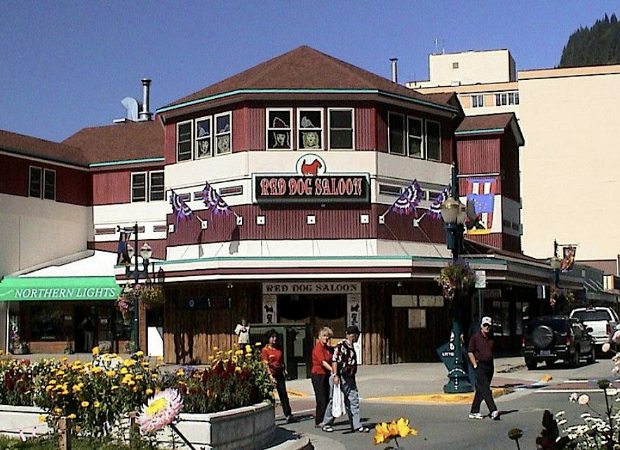
Commercial establishments lined Front Street, adjacent to wharves on Gastineau Channel. More permanent structures replaced the hastily erected boom town buildings. Juneau’s merchants prospered as lode gold mining operations expanded, and through the 1890’s and early 1900’s they invested in new buildings in town.
Today, many buildings from 1883-1939 stand in Juneau’s Downtown Historic District. Due partly to historic district design review standards the newly constructed buildings complement the earlier buildings in size and massing.
The neighborhood has an elongated “L” shape. The boundaries of the spine of the “L” include buildings on both sides of South Franklin Street from the old ferry terminal to Second Street where the greatest number of historic buildings are found.
The base of the “L” is bounded by Second Street to the northwest, Main Street on the west, a block of Front Street to the northeast, a block of Seward Street to the south , and Shattuck Way to southeast where the boundary makes several angles to include the buildings along South Franklin Street.
The Juneau downtown buildings are an excellent representation of early twentieth century commercial architecture in small Pacific coast communities.
Late Victorian, Late 19th and Early 20th Century American Movements, and Modern Movement architectural styles are represented by buildings in the Juneau Downtown Historic District.
Juneau Downtown Historic District National Register of Historic Places Listing
City and Borough of Juneau Inventory of Historic Sites and Structures, March 1986
-
Douglas Townsite
In December of 1880, prospectors were finding gold on the beaches of Douglas Island, across the channel from Juneau.
In May of 1881, a French Canadian named Pierre “French Pete” Erussard found gold at the mouth of a creek he named Paris, née Parris.
Erussard and other prospectors, staked placer and lode claims in the area. Douglas City was established to serve the new gold mining operations.
The boundaries comprising the Douglas Townsite historic neighborhood are generally the west side of First Street to the west side of Fifth Street and the north side of H Street to an irregular line along Bradley Street connected diagonally to the right of way shown as Kinzie Street. This area represents the original platted Douglas Townsite.
The neighborhood is composed of primarily residential buildings with a few commercial buildings along 3rd Street. Most buildings are wood frame construction reflecting the available materials and local building technology.
The only reinforced concrete structure is the Douglas School Gymnasium which was built in 1937. This construction method was likely influence by the higher technology brought to the area in the later years by the mining engineers.
Although many buildings in the neighborhood reference national architectural styles they were predominately modest in detailing. This is most likely a result of the economy of shipping materials to this remote part of the world and the availability of skilled craftsmen in the region.
Buildings within the Douglas Townsite neighborhood are representative of the historic socioeconomic character of the Douglas population which was predominately working class dependent on the mining industry.
The neighborhood was under much developmental pressure during the turn of the century as the community grew rapidly during the period of gold mining expansion. However, the great mining boom was followed by a devastating bust with the Treadwell cave-in in 1917.
Three town fires (1911, 1927, 1937) further devastated Douglas and in many ways the architectural character of the community never recovered.
The Douglas Townsite neighborhood comprises a unique area featuring examples of early period architecture reflective of the geographic and economic influences of the early development of Douglas.
-
Dorene Lorenz published Chicken Ridge Historic District in Historic Districts and Places 2023-10-15 19:38:23 -0800
Chicken Ridge Historic District
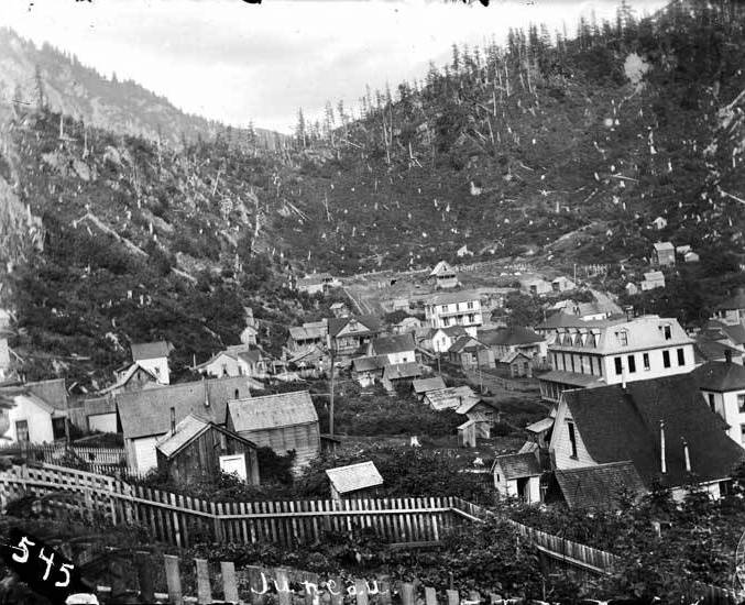 The Chicken Ridge Historic District neighborhood includes properties along Basin Road, past Seventh Street, all properties along Seventh Street, most properties on Main Street above Sixth Street, all properties on Goldbelt Avenue, and all properties on Dixon Street as well as a few properties on Calhoun Avenue.
Neighborhood growth was engendered by the large mining companies and the government alike and areas such as Chicken Ridge began to be settled. The area known as the Chicken Ridge Neighborhood, which overlooks the city of Juneau, was so named by miners because of the abundance of ptarmigan in the area.
The Chicken Ridge area was staked as a placer claim in May of 1890 by five men, one of whom was John F. Maloney, who was to eventually make his home on the ridge. The neighborhood which developed on Chicken Ridge was first settled in 1893.
During this period of gold mining expansion in the form of large mining companies and the subsequent expansion of Juneau’s role in territorial government, the need for living space increased the pressure to extend settlement in Juneau. An affluent socio-economic class comprised of Juneau’s attorneys, doctors, business owners, mining executives, government employees, and politicians settled the Chicken Ridge neighborhood.
Because of the location of the city, building materials were scarce and so were skilled craftsmen to do the work. Most buildings were modest interpretations of national stylistic trends which varied only according to the amount of detailing and square footage which could be afforded by the individual owner - ranging from craftsman and colonial revival to prairie school.
Listed contributing homes: Hammond-Wickersham House, McCloskey Mansion, Rustgard House, Norton House, Walker House, Jenne House, Thornton House, Cole/Carter House, Cole House, Mize House/Weather Bureau Station, Geyer House, Perelle House, Bradford House, Johnstone-Radelet House, and the Creese House.
Listed non-contributing homes include: Mullen/Hebert House, Hermann House, Torvinin House, and the Longenbaugh House.
-
Dorene Lorenz published Casey-Shattuck Historic Neighborhood in Historic Districts and Places 2023-10-15 19:31:59 -0800
Casey-Shattuck Historic Neighborhood
Much of the land area of the current Casey-Shattuck neighborhood was owned by William Casey who had a small dairy farm in the vicinity around the turn of the century. Henry Shattuck was an insurance broker and real estate developer. Together Casey and Shattuck developed the Casey-Shattuck subdivision which was the first addition to the original Juneau Townsite.
A 1986 historic sites and structures inventory identifies four properties of significance in the neighborhood. They are: 1) Shattuck Mansion, built by Juneau businessman Henry Shattuck; 2) Alaska Electric Light and Power Plant, constructed in 1914 on the site of an earlier power plant which burned down; 3) Evergreen Cemetery, Juneau’s municipal cemetery and burial site of Juneau’s founders Joseph Juneau and Richard Harris; and 4) Torkelson-Samuelson House, built by Olaf Torkelson who worked for the Alaska Juneau and Treadwell mines.
The boundaries of the Casey-Shattuck Neighborhood are generally Glacier Avenue on the west, the first row of properties north of Twelfth Street, Indian Street on the east, and Distin Avenue on the south side.
-
Dorene Lorenz published Alaska Coastal Airlines Hangars in Historic Properties 2023-10-15 19:25:05 -0800
Alaska Coastal Airlines Hangars
Alaska Native Tlingit and Haida people reportedly occupied Southeast Alaska for hundreds of years prior to European contact.
The Haida lived primarily in the southwestern portion of Southeast Alaska, while the Tlingit resided in the rest of the region. The Auk, Taku and Sumdum tribes of Tlingit people lived in what is now the City and Borough of Juneau at the time George Vancouver's crew noticed smoke from a campfire at an Auke Bay village. This first recorded account of the Auks was in 1794.
In 1867, The United States bought Alaska from Russia for $7.2 million dollars. Gold was known to exist in Southeast Alaska as early as the 1860s located in a string of highly mineralized deposits along the coastline from Windham Bay to Berners Bay.
George Pilz, a Sitka miner, was convinced that gold existed in the Gastineau Channel area when Chief Kowee of the Auk people brought him ore from the mouth of what was to be called Gold Creek. He outfitted two prospectors, Richard T. Harris and Joseph Juneau, and sent them to investigate. Following the creek to its headwaters in Silverbow Basin, they staked a claim on October 4, 1880.
Harris and Juneau established a 160 acre townsite at the beach near the mouth of Gold Creek on October 18, 1880 and named it Harrisburg. In early 1881, a town meeting resulted in the name being changed to Rockwell in honor of the Naval Commander that was sent to the area to establish law and order. By the end of 1881, Joe Juneau lobbied the local miners, complaining nothing in the district had been named for him, and it was agreed to change the town's name to Juneau. In 1900, Juneau was incorporated and named the seat of government for the Alaska Territory.
As early placer mining operations gave way to large underground mines, transportation of vast amounts of goods, materials, and people became increasingly important. The glacial, mountainous, and coastal terrain surrounding the Juneau area made overland transportation impossible. The only reasonable options were by sea and later air.
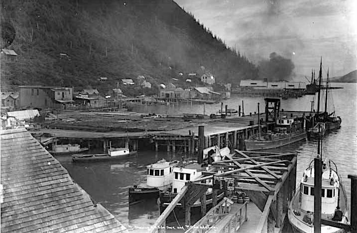
Juneau's harbor developed with a number of ship docks to handle the influx of commerce to support the growing community. By1901, the Pacific Coastal Steamship Company had a wharf and warehouse facility at the subject site. The facility served the shipping needs of the community until 1924, when Pacific Coastal was purchased by Admiral Line, a competing shipping company, and moved to another location on Juneau's waterfront.
The Juneau Motor Company purchased the property in 1924, and erected a garage and office on the wharf to serve their new business. This was Juneau's first Ford dealership as automobiles became popular.
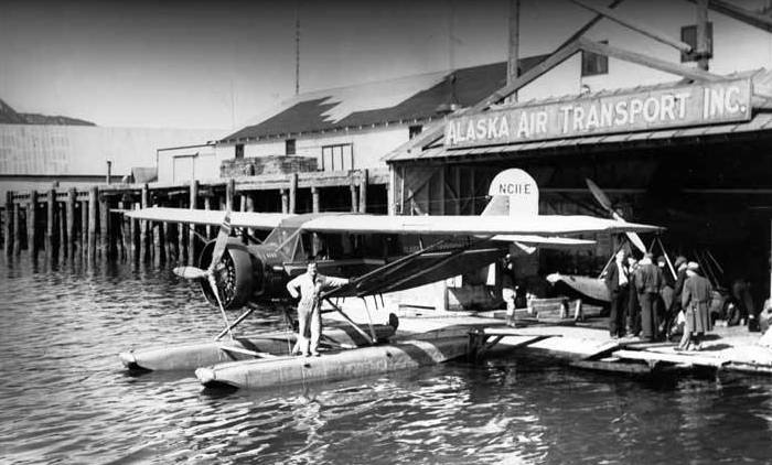
Aviation history was made on April 15, 1929, when Enscel Eckmann flew into Juneau in his Lockheed Vega named "Juneau." It was the first non-stop flight from Seattle to Alaska. Shortly after arriving, Eckmann formed Alaska-Washington Airways, Juneau's first airline. Alaska-Washington Airways operated out of a hangar built atop a large log raft anchored in front of the Juneau Motor Company facility. During the 1930s there were a number of companies providing float plane service out of the Juneau Harbor. These included Alaska Southern Airways, Pacific Alaska Airways, Panhandle Air Transport,Alaska Air Transport, and Marine Airways.
In 1936, the Juneau Motor company's building and dock were demolished by Alaska Air Transport (AAT) to make way for a hangar and repair shop. Local investors funded the hangar which was built to house five planes. The 5,000 square foot hangar was used in conjunction with a floating hangar already owned by AAT. A wood and steel ramp connected the new hangar to the sea level floating dock allowing loading/unloading of passengers and cargo.
In addition, a lift system, composed of a long boom, slings, pulleys and railroad tracks,was developed to lift planes out of the water and transport them into the hangar on the wharf. The 'crane' was designed by Shell Simmons and used for the first time to lift AAT's Bellanca on August 27, 1936.
Fire destroyed the Alaska Air Transport hangar on June 10, 1938. The Daily Alaska Empire (currently Juneau Empire) reported the fire started from a welding torch that ignited the fabric of a Bellanca Skyrocket float plane. Damage from the fire was estimated at $25,000 and included destruction of the Bellanca Skyrocket, substantial damage to the buildinq, and destruction of machinery, parts and tools. The buildinq was insured and plans were made to rebuild.
Sheldon "Shell" Simmons, owner of Alaska Air Transport, was quoted as saying, "We're in the flying business, same as usual."
Between 1938 and 1939,a new Alaska Air Transport hangar was constructed. In July 1940, Alaska Air Transport and Marine Airways merged to become Alaska Coastal Airlines. After the merger the new company purchased the hangar from the private owner from whom they had been leasing. In 1946, the building underwent a major renovation including a hangar addition of approximately 10,000 square feet. In addition, office space was added in 1951, and a baggage handling area was constructed in 1957. In the 1950's, Alaska Coastal Airlines served 33 towns throughout Alaska, only four of which had airports. Alaska Coastal Airlines was recognized as a model of independency because they were at least 1,000miles away from any repair-shop or parts department, thus all servicing and repairs were done in house.
In the July1959 issue of Popular Mechanics the article, "Alaska's Flying Bus Line", praised Alaska Coastal Airlines as being, "...a most unique air operation that's a tribute to old-fashioned American ingenuity." Many innovations came out of the Alaska Coastal Airlines hangar over the years, in order to combat the harsh Alaska climate and lack of available parts as well as making planes more efficient. Alaska Coastal Airlines retrofitted the first "Turbo Goose" by replacing the original engines with Pratt and Whittney PT6A turboprops.
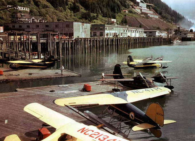
Coastal Ellis Airlines continued their operations out of the Alaska Coastal hangar. They owned and operated the greatest exclusively amphibian airline in the world, with the largest fleet of the legendary Grumman Goose in private hands. Today five of Alaska Coastal Ellis Airline planes sit in museums around the world. These museums include the McChord Air Force Museum in Washington, DC, the National Canadian Aviation Museum in Ottawa, the Tongass Historical Museum in Ketchikan, the Yanks Air Museum in Greenfield,California, and the Swedish Air Force Museum in Linkoping.
In 1968, Alaska Airlines purchased Alaska Coastal Ellis Airlines. Alaska Airlines did not wish to continue float plane operations based out of the Alaska Coastal Airlines Hangar building, so Dean Williams and Bill Bernhardt formed Southeast Skyways in late 1968 to fill the void, renting the hangar facility from Alaska Airlines. Southeast Skyways was strictly charter until 1969, when Alaska Airlines asked Southeast Skyways to take over the former Alaska Coastal Ellis Airline routes.
In 1974, Henry Camarot, Louis Dischner, and Frank Irich purchased the Alaska Coastal Airlines Hangar. The building was remodeled for use as a retail center with restaurants, shops, and offices. They named the bulldinq "Merchant's Wharf" which continues to serve as a retail center today.
About this time Southeast Skyways was purchased by Wings of Alaska. Although the hangar and repair facilities have been converted to retail uses, Wings of Alaska continues to operate from a floating dock to serve the tourist trade. These floats and associated aircraft activity are reminiscent of former operations at this location and serve as a reminder of the history and historic events of this aspect of Juneau's past.
Alaska Coastal Airlines Hangar Historic Survey, September 2006
-
-
Dorene Lorenz published Richard Harris & Joseph Juneau Memorial in Past Projects 2023-10-08 14:58:44 -0800
Richard Harris & Joseph Juneau Memorial
For the most part, the vast spruce covered mountains and protected waterways along Gastineau Channel in Southeastern Alaska laid untouched to the mid 1800s.
Before that, Tlingit Indian tribes fished the rich salmon routes for centuries, and a few well-known explorers had come before: Men such as George Vancouver and John Muir.
Read more
2025-2026 Chairman, 2024 Commissioner, Alaska State Commission for Human Rights. 2025 United Nations Geneva Human Rights Crisis State & Local Panelist. 2024 Alaska State Delegate, America 250 Convening of the States. 2023-2024 Commissioner, Alaska Historical Commission. 2025-2026 Chairman, 2019-2024 Committee Member, City & Borough of Juneau Historic Resources Advisory Committee. 2024-2025-2026 Sons of Norway Svalbard Lodge Juneau Historian. 2024-2025-2026 Filcom Member. 2018-2020 Committee Member, City & Borough of Juneau Sister Cities Committee. 2019-2020 Member, AVTEC Institutional Advisory Committee. 2006-2020, President & COB, Friends of Jesse Lee Home. 2012 Member, Anchorage Arts Advisory Commission. Anchorage International Film Festival Features Committee Chair/Host/Award Presenter. Balto Film Fest Founder.
2004 Seward City Council. 2002-2006, Seward Centennial Legacy Committee, Seward Economic Development Committee, Seward Waterfront Committee, Seward Alternate Energy Committee, Seward Long-term Care Replacement Facility Committee, and Seward Historic Preservation Commission.